There has been and is so much talk by Drumpf about building a wall, a BIG wall, on the US – Mexico border. Here is John Oliver on Drumpf's southern wall.
And at one time, Scott Walker floated the not so new idea of building a wall on the Canada – US border, which Drumpf momentarily supported. This 09/2011 Huffington Post article should make you wonder. Walker was just the most recent iteration of that debate.
"The United States is looking at building fences along the border with Canada to help keep out terrorists and other criminals."
This is all in support of national security. But I would rather think of it as being in support of national xenophobia.
But what is the Canada – US border? It really is quite funny and interesting.
"The Canada–United States border (French: Frontière entre le Canada et les États-Unis), officially known as theInternational Boundary, is the longest international border in the world. It is shared between Canada and the United States of America, the second and fourth largest countries by area respectively. The terrestrial boundary (including small portions of maritime boundaries on the Atlantic, Pacific, and Arctic coasts, as well as the Great Lakes) is 8,891 kilometres (5,525 mi) long, of which 2,475 kilometres (1,538 mi) is with Alaska." — Wikipedia
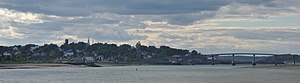
The line between Canada and the United States is renowned for being the longest undefended border in the world but, as Canadian photographer Andreas Rutkauskas discovered on an epic road trip, there's more to it than meets the eye. …
"My goal was to present the border as something which is bucolic and porous and that's not necessarily the way it is," he said. "Most of the photographs in the project, they look benign and innocent as if you could just walk from one nation to another. But that's really not the case."
Before or after almost every shot Rutkauskas had an encounter with someone from U.S. Border Patrol, the RCMP or the Canada Border Services Agency.
Some were helpful, even moving their cars so he could get the shot he wanted, and giving him recommendations on where to go next. They made it clear, however, what he could and could not take pictures of because of security restrictions.
With others, he had "heated conversations" and those came when Rutkauskas stood in "no man's land."
Inserted from CBC
The most eastern border crossing is Lubec – Campobello Border Crossing connecting the towns of Lubec, Maine and Welshpool, New Brunswick.
While the main western crossing is The Peace Arch crossing at Surrey, BC and Blaine, WA, there is a small crossing at Point Roberts, WA — Point Roberts being a "mistake" made by the Border Commission. And of course there are crossings with BC – Alaska and the Yukon – Alaska.

And then there are the towns of Stanstead, Que., and Derby Line, Vermont. The border runs through these two adjoined communities, sometimes even through buildings.

A thick, white line separating Canada and the U.S. runs between the towns. Not only does it appear on streets and properties, but it also runs through some buildings, like the Haskell Free Library and Opera House (left), which was intentionally built on the boundary in 1904 so that both Canadians and Americans could use it. From Canadian Geographic

Andreas Rutkauskas shot this photo of the Okanogan National Forest at the Washington State-British Columbia border on his cross-country journey of the border, which he said brought his childhood geography lessons to life. (Andreas Rutkauskas)

At this border crossing between Emerson, Man., and Pembina, N.D., X-ray imaging scanners are used to inspect railway cars. (Andreas Rutkauskas)
Please check out the photos in the CBC article. There are some magnificent shots.
Will this border, the 49th parallel, endure?
America's less-famous first Constitution included an invitation to Canada to join the U.S. It remained open from 1781 until the U.S. Constitution everyone knows was finalized in 1789. A 2004 poll from Leger marketing found just 7 per cent of Canadians were even vaguely interested in merging with the U.S. So obviously, Canada made the right call. America didn't learn its lesson. Huffington :Post
Probably.

10 Responses to “From Sea To Sea — A Mari Usque Ad Mare”
Sorry, the comment form is closed at this time.
Such gorgeous country!! and beautiful pictures! I like #8, and I'd like to live there.
What a shame about Gordie's friend, who happens to be a dual citizen, and goes over the 'line' to visit his friend. Too much paranoia and xenophobia nowadays.
http://www.ask.com/youtube?q=why+can%27t+we+be+friends%3F&v=5DmYLrxR0Y8&qsrc=472
Thank you, Lynn for this wonderful post.
Very enjoyable while being educational – thanks. I wonder how they do the taxes on buildings that are divided by the border.
And on a related note, North Dakota's state nickname is 'The Peace Garden State" – it's on their license plates. It's one of the few states I haven't visited yet, so I had to look up the height of those Peace Towers featured in one of the photos in the Peace Garden – they are 120' tall.
(Just a teeny, tiny nit to pick – and not to get all "Latiny" again – but since it's Canada's motto I just want to note it's "A Mari usque ad Mare")
Tibi gratias.
My bad! You are correct so I fixed. Thanks Nameless!
Et gratias tibi.
"Imagine a bulldozer in your family graveyard." A good line. A horrible concept. But a big part of our problem is that the kinds of people who think a wall is a solution HAVE no imagination. I'm back to my contention that American brains have been permanently crippled by pollution.
Thanks Squatch! Exhausted Hugs!
I vote for waffle irons…they'd look OK on top of the monuments, too, if there are any left over
Thanks for this post, seems Canada made the right decision.
Just loved this post, Lynn. As Nameless already mentioned: both enjoyable and educational.
If Drumpf or, God forbid, Cruz (yes, that's a pun) should win the election, Canada might consider taking Drumpf and Walker up on their proposal to build a wall along the border between Canada and the US; Drumpf-style of course, with all expenses paid by America. Not because of xenophobia, but for reasons of not having enough resources to accommodate all those desperate Americans fleeing Drumpf's or Cruz's mad empire.
It is a weird border though, just as much as this post suggests. By usual route (car on highway) rather tedious to pass because of the inspections and many questions asked on both sides, but we passed the Yukon-Alaskan border once in a camper van at four o'clock in the morning to go and watch bears catch salmon up some shallow river. There wasn't a soul in sight to man the border post at that time, but at that time on a beat-up road leading from nowhere in Canada to absolutely nowhere in Alaska that wasn't very surprising. On our return around noon the post was manned, but they couldn't be bothered to inspect us and waved us through after glancing at our Dutch passports. People traffickers will love that post when Drumpf comes to power. 😉